Plastic pollution and climate change, which we have all heard about umpteen times and will no doubt hear about more and more often, tend to be seen as two distinct issues. The truth is, however, that they are inextricably connected, not least because of their shared fossil-fuel origin. As such, they are counted among the greatest contemporary environmental challenges, both globally and in the Arctic.
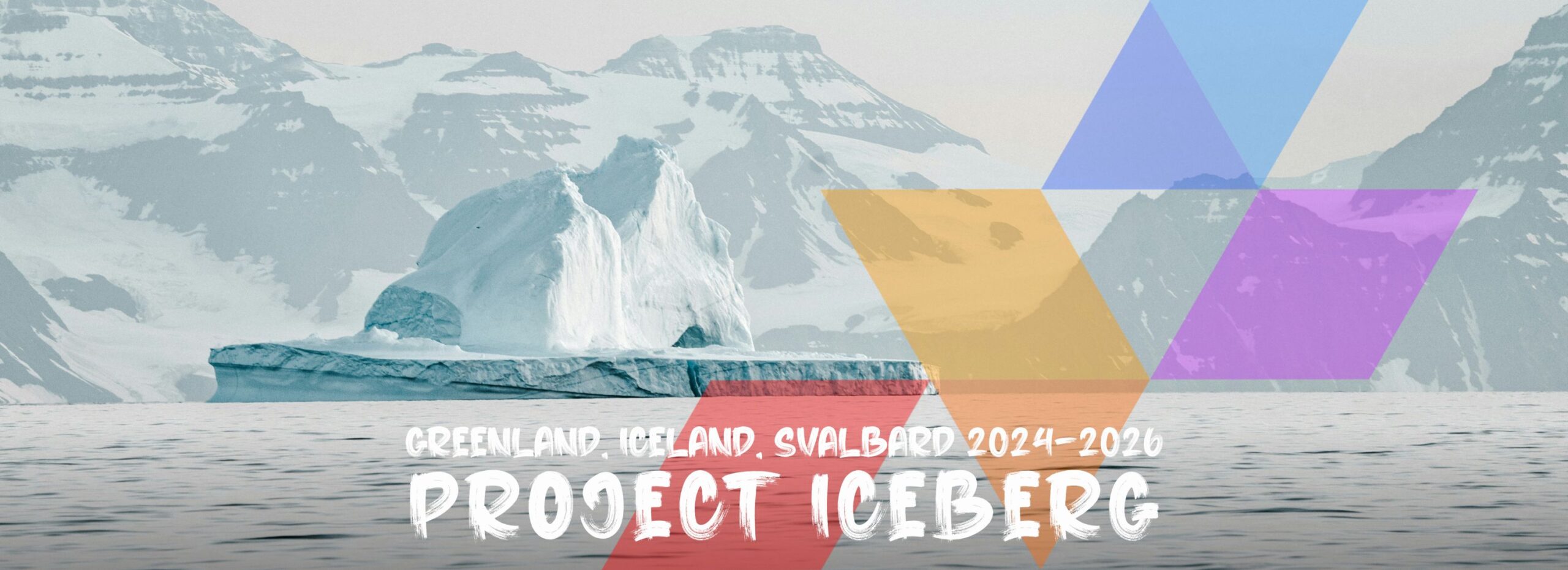
No wonder, therefore, that it is the deepening pollution crisis in the context of the deepening climate change that lies at the core of project

The full name of the undertaking is Innovative Community Engagement for Building Effective Resilience and Arctic Ocean Pollution-Control Governance in the Context of Climate Change. But although the name gives a fair idea of what we’re after, it certainly is a mouthful. Luckily, we have a shorter and more user-friendly alternative for daily use. ICEBERG.
Project ICEBERG, planned for the years 2024–2026, received funding from the European Union’s Horizon Europe Research and Innovation funding programme under grant agreement no 101135130.

The project is quite something, for our standards at least. Sixteen institutions from nine countries. Six work packages. Three regions of the Far North. Countless tasks, samples, experiments, analyses, meetings and models. And a single ambitious goal. A cleaner Arctic.
If you wish to learn more about the structure, aims and assumptions of project ICEBERG, meet the team involved in the execution of project tasks, read fieldwork accounts and share your own reflections on pollution in Greenland, Iceland or Svalbard, check out the project’s official website and social media channels:
And if it’s our role in project ICEBERG that you’re particularly curious about, stay where you are and keep reading.
MORE THAN THE SUM OF ITS PARTS
Project ICEBERG is carried out by sixteen separate units, which include higher education institutions, research centres, service businesses and non-profit organisations. Each project partner brings into the project a unique set of expertise, know-how, interests, skills, abilities and contacts. It is thanks to us all working together that ICEBERG can be exactly what it is.
WHAT WE BRING INTO THE PROJECT
Expertise in marine litter distribution & accumulation in remote areas of Svalbard
Extensive experience in Arctic fieldwork
and logistics

Familiarity with a range of environmental sampling techniques

Strong professional research network

Enthusiasm, dedication and hard work
for a cleaner Arctic
Individual strengths of project partners helped to define the roles they now play in the project.

WORK PACKAGE LEADER
The forScience Foundation was chosen as the leader of the work package whose goal is to assess pollution sources, distribution, and impacts in Arctic ecosystems. Ambitious, right? The work package which we lead, referred to simply as WP1, comprises eleven tasks which investigate various types of pollution, from wastewater discharged by sea-going vessels, through persistent organic pollutants (knows as POPs) released into the environment from melting glaciers, to plastic litter washed onto Arctic shores by the waves. Are we experts on all that? Of course not. But the WP1 team as a whole is. All that is left for us to do is make certain the work is moving forward, keep an eye on deadlines, ensure effective information flow, represent WP1 before the project consortium and – most importantly perhaps – not get in the way.
Other than that, we also have two tasks of our own and contribute to a couple more. The individual tasks of the forScience Foundation focus on two types of pollutants: stranded marine litter and heavy metals.
MARINE LITTER TASK
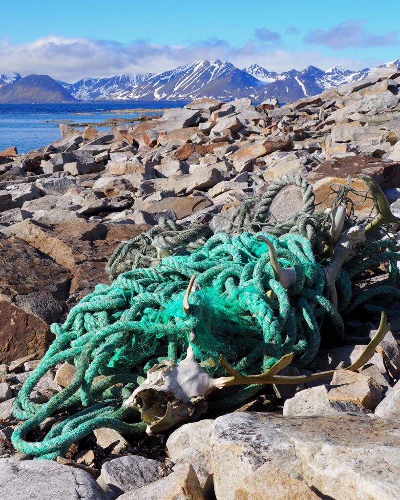
The work we do on the topic of marine litter is a continuation and elaboration of Sørkapp Marine Litter Cleanup project, which we completed in the years 2019–2021.
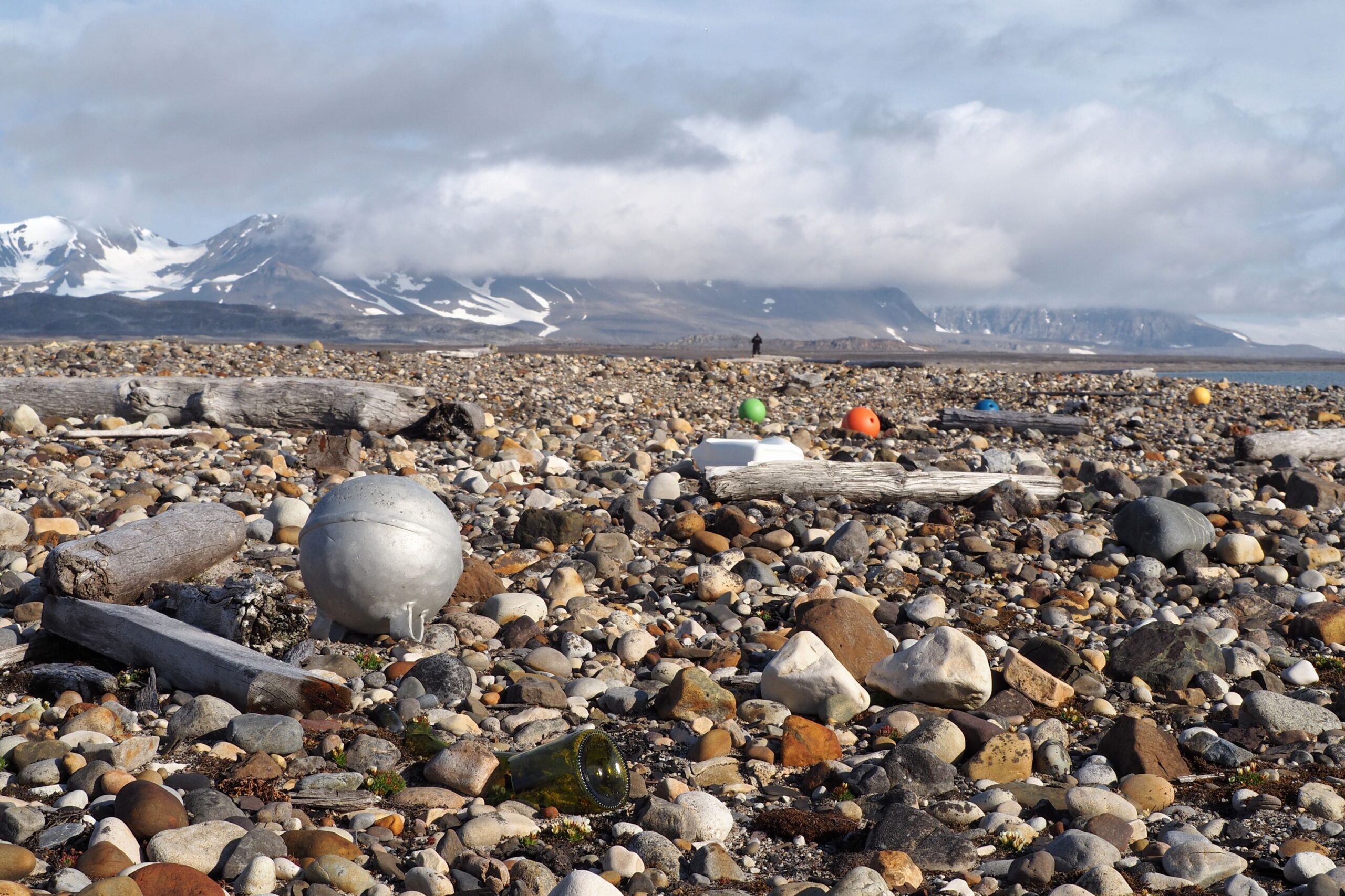
In other words, we once again focus on the issue of stranded marine litter in remote areas of Southern Spitsbergen, combining scientific research with down-to-earth practical work for the sake of the Arctic’s natural environment.
Task details
WHERE WE DO IT
The marine litter task is carried out along the north-western edge of Sørkappland, which is the southernmost tip of Spitsbergen. Why there, of all places?
Sørkappland is a classic wilderness. The area is home to a few species of animals, but as far as humans go, it is totally uninhabited. Guests arrive rarely because there’s no tourist infrastructure or public transport and non-public alternatives are not only outrageously expensive but also entirely dependent on the weather, which is notoriously fickle. To complicate the logistics even further, Sørkappland lies within a national park, which means that all scientific research, camping or trekking require prior approval from the Governor of Svalbard. The resulting inaccessibility protects the area from negative consequences of direct human activity, including littering.
At the same time, due to the distribution of ocean currents, the west coast of Sørkappland is the first potential accumulation zone for marine litter arriving in the area from lower latitudes and from the Barents Sea, which lies between Svalbard and the Russian Arctic.
The combination of these two factors – inaccessibility and ocean currents – makes Sørkappland the perfect place for marine litter research. This is because, on the one hand, there is plenty to study and, on the other, no one will come and mess with the results. But there’s one more thing, no less important. Sørkappland has so far been off the radar (and perhaps also beyond the reach) of other teams collecting marine litter and marine litter data in Svalbard. This means that by choosing this exact target area we fill an important gap in pollution research and environmental protection.
Background photo: Anita Horowska, forScience Foundation
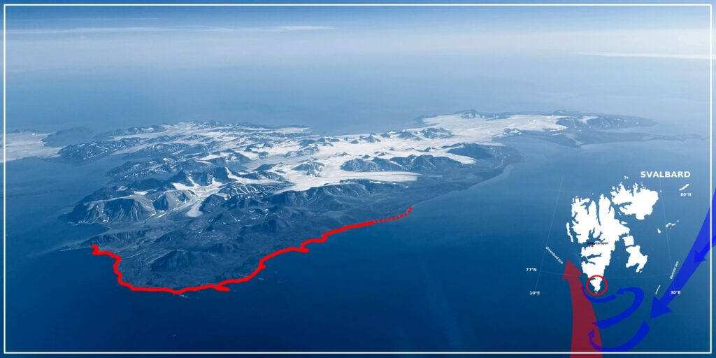
What can you see in the above image? Our target area, which covers a whopping 36 kilometres of the coast. The solid red line shows the 32-kilometre section where we carried out the already mentioned Sørkapp Marine Litter Cleanup. In 2024, under project ICEBERG, we went back there to collect the litter washed ashore within the previous three years and verify our earlier conclusions regarding litter accumulation rate in the area. On top of that, we cleaned up four extra kilometres (marked with the dotted line), because litter-picking is highly addictive. Even more so if it provides quality litter data.
The arrows in the bottom right corner of the image indicate the location of ocean currents. The red arrow shows the West-Spitsbergen Current, a branch of the Gulf Stream, which carries northwards warm(ish) water from the south. The blue arrows are the cold East-Spitsbergen Current flowing from the Arctic Ocean. What do they have in common? Proximity to Svalbard. And the fact that, apart from water, they also carry litter.
WHY WE DO IT
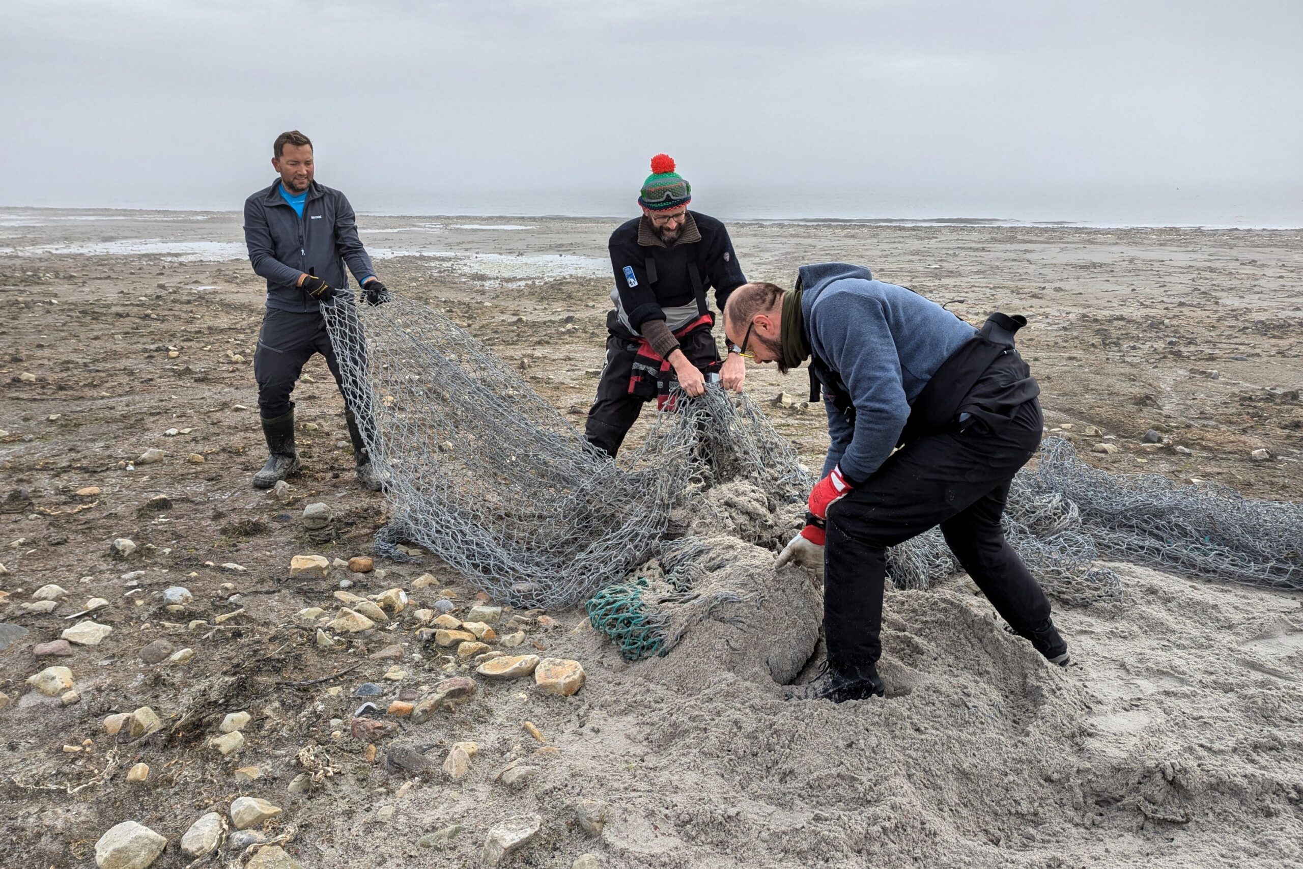
The clean-up work done by the forScience team in Svalbard stems from our deep conviction that education and legislation, which are commonly seen as the most efficient weapons in the fight against the growing amounts of litter, are not enough to solve the problem. Mainly because they cannot undo the damage that has already been done. To increase the efficiency of initiatives aimed at improving the situation, raising awareness and limiting production must go hand in hand with active removal of plastic waste which has already made it into the environment. And there’s no time to lose, because pollution causes damage. It’s as simple as that*. Besides, due to inevitable processes of degradation and fragmentation, the items which today still qualify as litter and, as such, can be quite easily removed, will soon turn into unremovable microplastic. A whole lot of it! Scientists estimate that even if, hypothetically speaking, the amount of plastic waste in marine and coastal environments stayed precisely at its current level, the degradation of what’s already there will likely cause the concentration of microplastic particles in the world’s oceans to double by mid-century. To prevent it, the world needs clean-ups. And that’s exactly what we do.
*If that’s not quite the justification you were expecting, check out our article “Does size matter? Or mega problems with macro- and microplastics”. There you’ll find a lot more information to support our opinion on the damaging impacts of litter.
The forScience team at work © Adam Nawrot, forScience Foundation
But that’s not the end of the story. Our litter work provides immediate benefits to the local ecosystem, but at the same time it informs… education and legislation, which we mentioned at the beginning. The Arctic follows its own rules, which is why global statistics, according to which the most popular litter items are cigarette butts and food wrappers, do not hold true for the far north. To better understand the local litter situation, it is vital to carefully analyse the litter washed ashore on local beaches. And that’s precisely what we do. As a result, we see quite plainly what should be the focus of future awareness campaigns and who their target audience should be. Besides, labels and other markings found on some litter items make it possible to identify companies responsible for the items’ production. The information may prove useful to local authorities, especially now that the topic of Extended Producer Responsibility (EPR) is increasingly on everyone’s lips. EPR is a rule according to which it’s not the consumer, but the entity that puts the product on the market that’s held responsible for its proper disposal. Brand identification of stranded marine litter will likely help to enforce the rule more effectively and at the same time expose greenwashing, which the biggest polluters often excel at.
Anything else? You bet! The fact that instead of moving from place to place every season, we merely extend our existing target area by extra kilometres, makes it possible for the forScience team to keep an eye on what’s going on within the previously cleaned section. As a result, we can draw conclusions about marine litter accumulation rate in the studied area and the ways in which it is affected by coast topography and orientation. This, in turn, makes it possible to more accurately anticipate marine pollution levels and more effectively plan future clean-ups, both in Sørkappland and in other, similar regions of the Arctic, too remote to scout out in advance.
© Barbara Jóźwiak, forScience Foundation
© Barbara Jóźwiak, forScience Foundation
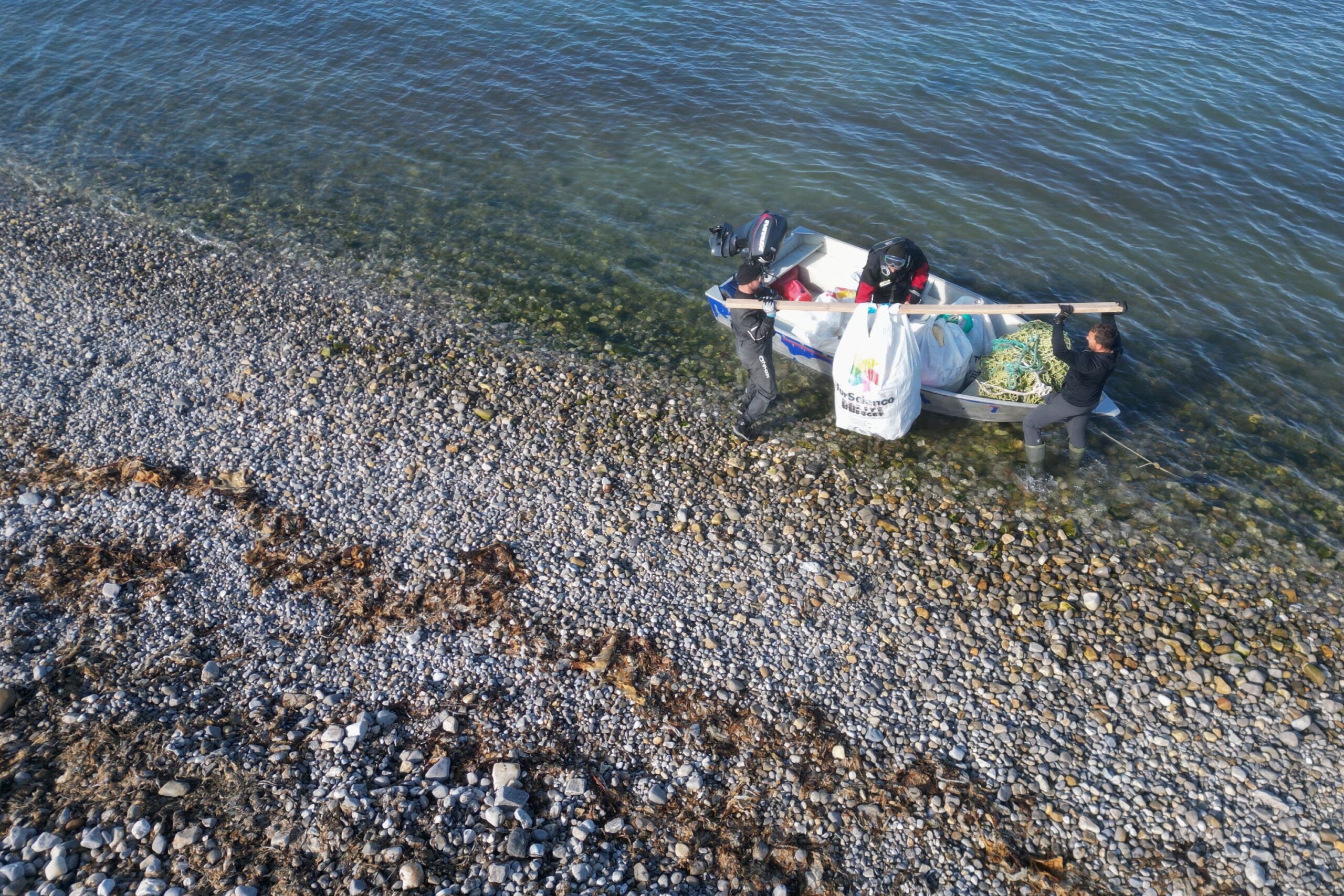
© Anita Horowska, forScience Foundation
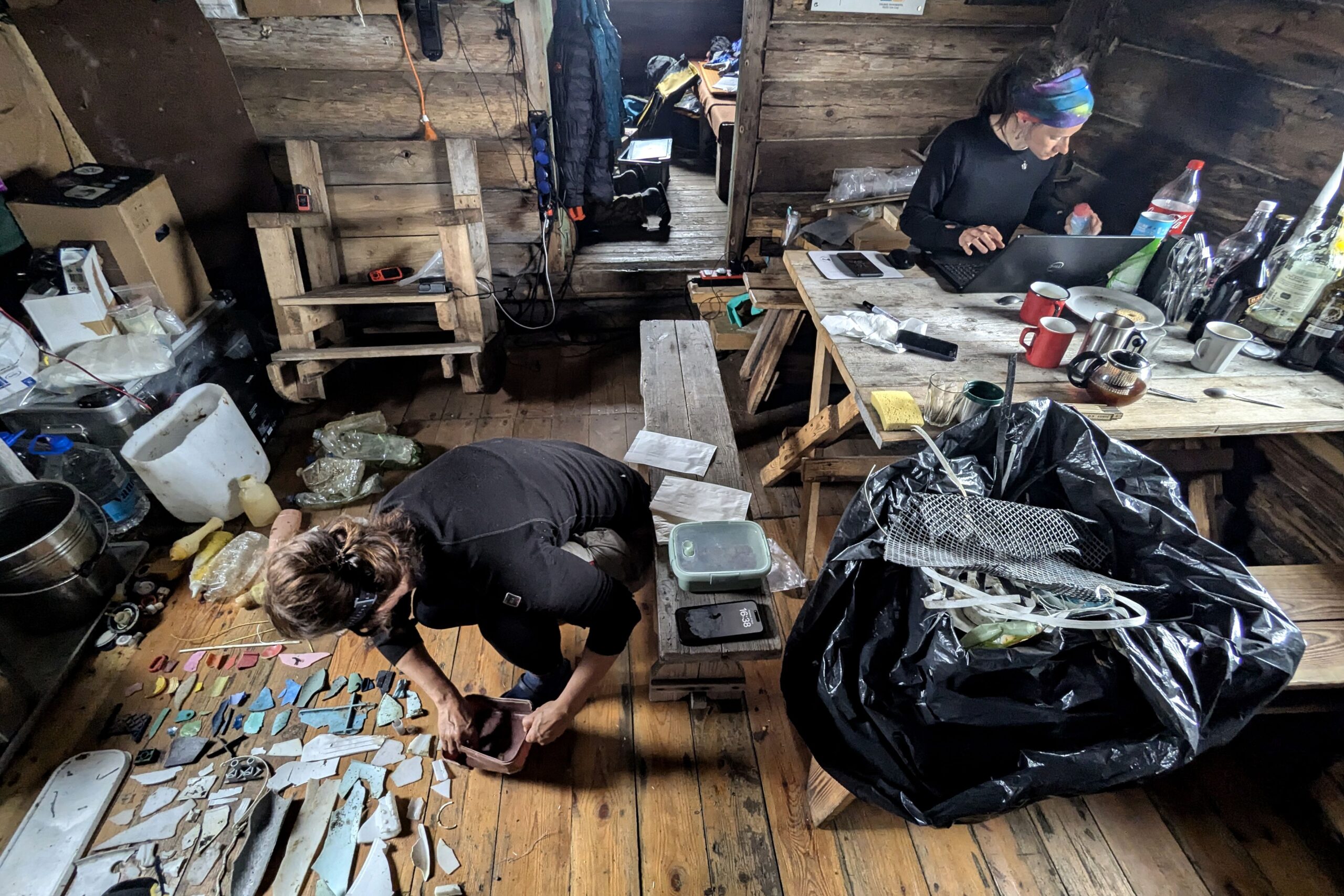
© Adam Nawrot, forScience Foundation
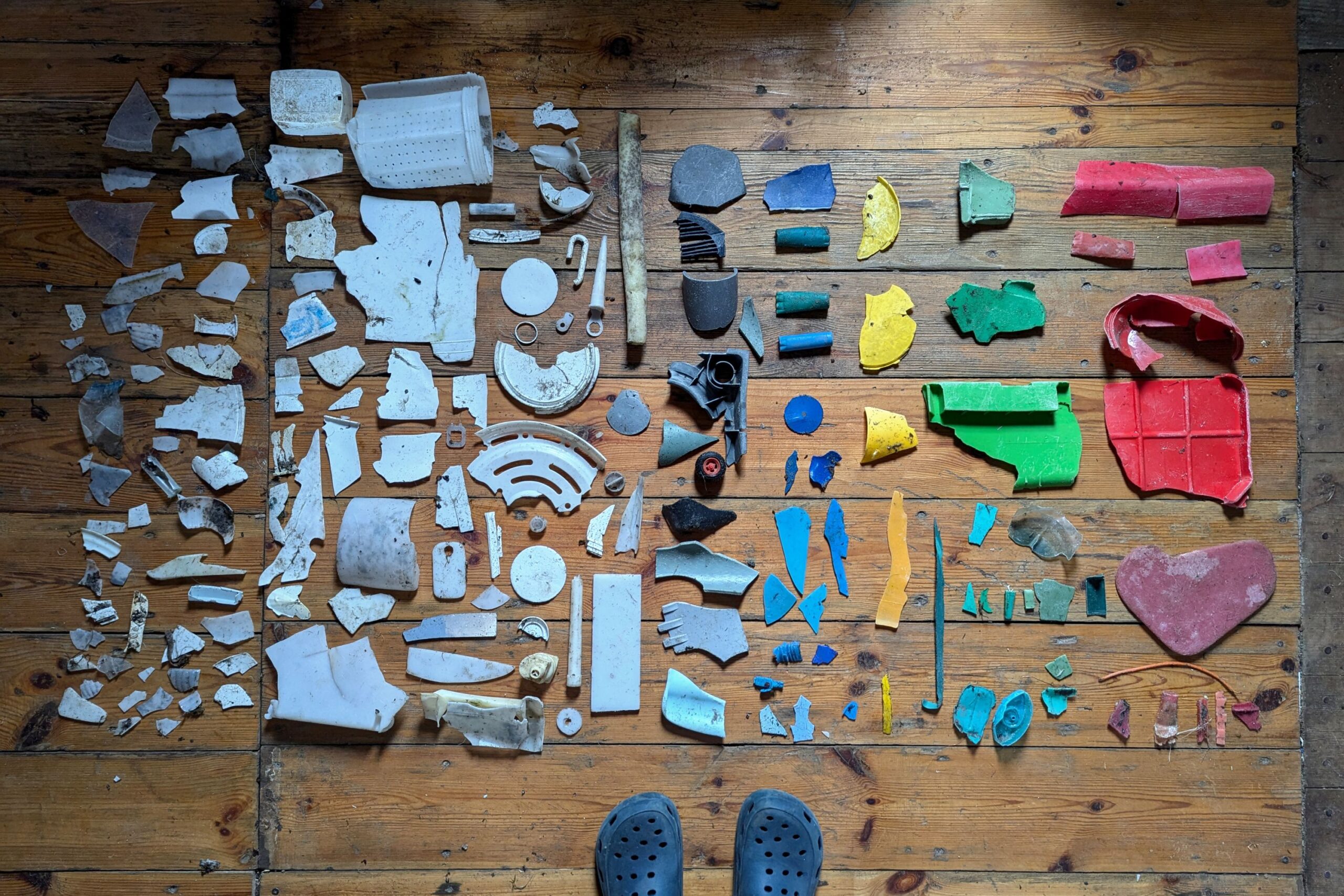
© Barbara Jóźwiak, forScience Foundation
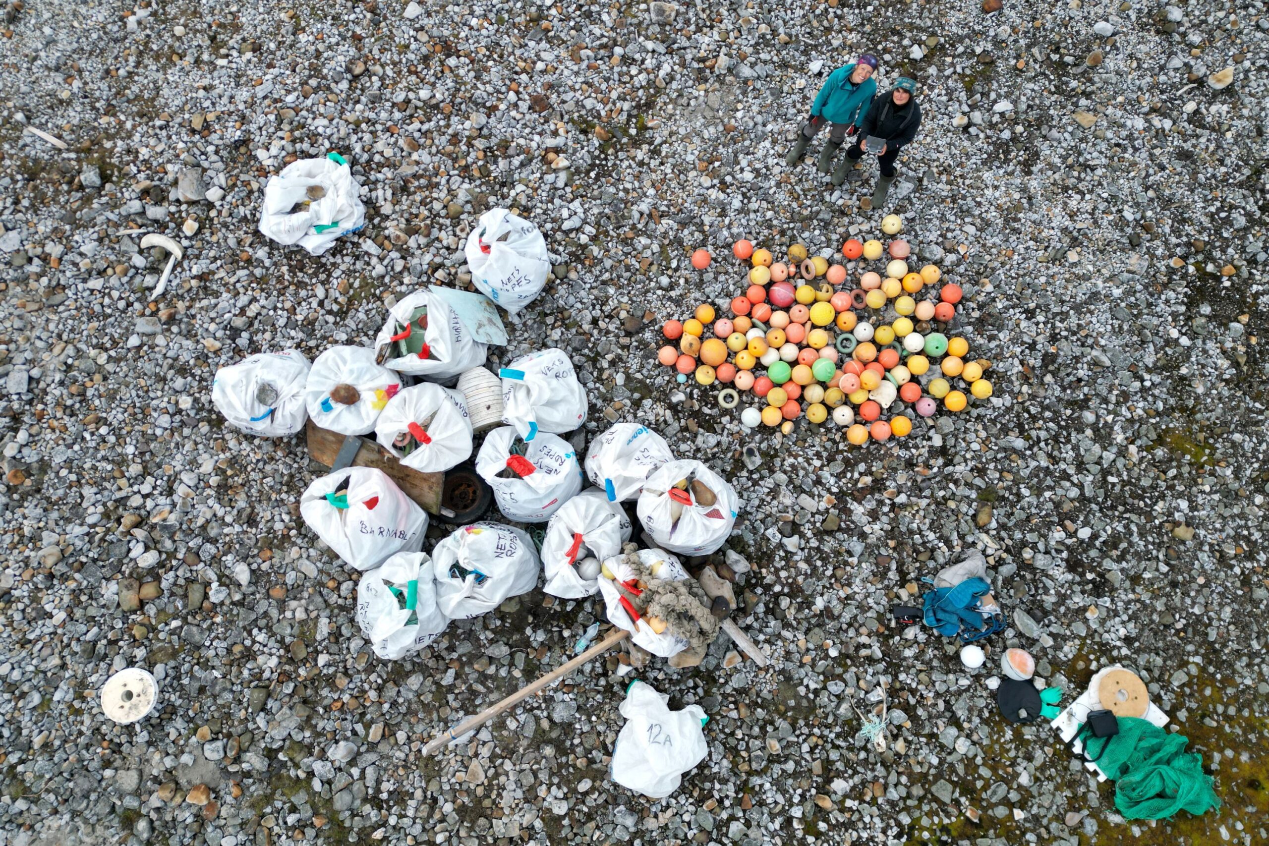
© Anita Horowska, forScience Foundation
WHAT SETS US APART
There are quite a few projects carried out in Svalbard, whose aim is to remove stranded marine litter, estimate the scale of litter pollution or determine litter sources and human behaviours due to which litter items end up on local beaches. The methodology, however, differs significantly from one initiative to another. The main priority for many of them is collecting marine litter data and not the litter itself, while those in which scientific deliberations regarding the rising levels of litter pollution are less relevant than beach cleaning activity, often focus on random sections of the coast and seldom document the scope and effects of completed work in sufficient detail. The forScience team, on the other hand, combines scientific goals (comprehensive data collection) with practical ecological objectives (thorough beach clean-ups), killing two proverbial birds with one stone. And we do this in the area where – due to its characteristics – it is especially needed.
Up for even more information? Go ahead and visit our Facebook page.

MARINE LITTER TASK
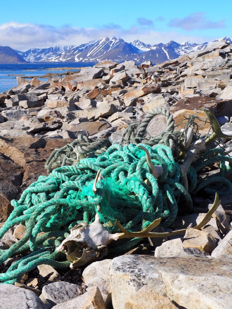
The work we do on the topic of marine litter is a continuation and elaboration of Sørkapp Marine Litter Cleanup project, which we completed in the years 2019–2021.
In other words, we once again focus on the issue of stranded marine litter in remote areas of Southern Spitsbergen, combining scientific research with down-to-earth practical work for the sake of the Arctic’s natural environment.
Task details
WHERE WE DO IT
The marine litter task is carried out along the north-western edge of Sørkappland, which is the southernmost tip of Spitsbergen. Why there, of all places?
Sørkappland is a classic wilderness. The area is home to a few species of animals, but as far as humans go, it is totally uninhabited. Guests arrive rarely because there’s no tourist infrastructure or public transport and non-public alternatives are not only outrageously expensive but also entirely dependent on the weather, which is notoriously fickle. To complicate the logistics even further, Sørkappland lies within a national park, which means that all scientific research, camping or trekking require prior approval from the Governor of Svalbard. The resulting inaccessibility protects the area from negative consequences of direct human activity, including littering.
At the same time, due to the distribution of ocean currents, the west coast of Sørkappland is the first potential accumulation zone for marine litter arriving in the area from lower latitudes and from the Barents Sea, which lies between Svalbard and the Russian Arctic.
The combination of these two factors – inaccessibility and ocean currents – makes Sørkappland the perfect place for marine litter research. This is because, on the one hand, there is plenty to study and, on the other, no one will come and mess with the results. But there’s one more thing, no less important. Sørkappland has so far been off the radar (and perhaps also beyond the reach) of other teams collecting marine litter and marine litter data in Svalbard. This means that by choosing this exact target area we fill an important gap in pollution research and environmental protection.

Background photo: Anita Horowska, forScience Foundation
What can you see in the above image? Our target area, which covers a whopping 36 kilometres of the coast. The solid red line shows the 32-kilometre section where we carried out the already mentioned Sørkapp Marine Litter Cleanup. In 2024, under project ICEBERG, we went back there to collect the litter washed ashore within the previous three years and verify our earlier conclusions regarding litter accumulation rate in the area. On top of that, we cleaned up four extra kilometres (marked with the dotted line), because litter-picking is highly addictive. Even more so if it provides quality litter data.
The arrows in the bottom right corner of the image indicate the location of ocean currents. The red arrow shows the West-Spitsbergen Current, a branch of the Gulf Stream, which carries northwards warm(ish) water from the south. The blue arrows are the cold East-Spitsbergen Current flowing from the Arctic Ocean. What do they have in common? Proximity to Svalbard. And the fact that, apart from water, they also carry litter.
WHY WE DO IT
The clean-up work done by the forScience team in Svalbard stems from our deep conviction that education and legislation, which are commonly seen as the most efficient weapons in the fight against the growing amounts of litter, are not enough to solve the problem. Mainly because they cannot undo the damage that has already been done. To increase the efficiency of initiatives aimed at improving the situation, raising awareness and limiting production must go hand in hand with active removal of plastic waste which has already made it into the environment. And there’s no time to lose, because pollution causes damage. It’s as simple as that*. Besides, due to inevitable processes of degradation and fragmentation, the items which today still qualify as litter and, as such, can be quite easily removed, will soon turn into unremovable microplastic. A whole lot of it! Scientists estimate that even if, hypothetically speaking, the amount of plastic waste in marine and coastal environments stayed precisely at its current level, the degradation of what’s already there will likely cause the concentration of microplastic particles in the world’s oceans to double by mid-century. To prevent it, the world needs clean-ups. And that’s exactly what we do.
*If that’s not quite the justification you were expecting, check out our article “Does size matter? Or mega problems with macro- and microplastics”. There you’ll find a lot more information to support our opinion on the damaging impacts of litter.
The forScience team at work © Adam Nawrot, forScience Foundation
But that’s not the end of the story. Our litter work provides immediate benefits to the local ecosystem, but at the same time it informs… education and legislation, which we mentioned at the beginning. The Arctic follows its own rules, which is why global statistics, according to which the most popular litter items are cigarette butts and food wrappers, do not hold true for the far north. To better understand the local litter situation, it is vital to carefully analyse the litter washed ashore on local beaches. And that’s precisely what we do. As a result, we see quite plainly what should be the focus of future awareness campaigns and who their target audience should be. Besides, labels and other markings found on some litter items make it possible to identify companies responsible for the items’ production. The information may prove useful to local authorities, especially now that the topic of Extended Producer Responsibility (EPR) is increasingly on everyone’s lips. EPR is a rule according to which it’s not the consumer, but the entity that puts the product on the market that’s held responsible for its proper disposal. Brand identification of stranded marine litter will likely help to enforce the rule more effectively and at the same time expose greenwashing, which the biggest polluters often excel at.
Anything else? You bet! The fact that instead of moving from place to place every season, we merely extend our existing target area by extra kilometres, makes it possible for the forScience team to keep an eye on what’s going on within the previously cleaned section. As a result, we can draw conclusions about marine litter accumulation rate in the studied area and the ways in which it is affected by coast topography and orientation. This, in turn, makes it possible to more accurately anticipate marine pollution levels and more effectively plan future clean-ups, both in Sørkappland and in other, similar regions of the Arctic, too remote to scout out in advance.

© Barbara Jóźwiak, forScience Foundation

© Barbara Jóźwiak, forScience Foundation

© Anita Horowska, forScience Foundation

© Adam Nawrot, forScience Foundation

© Barbara Jóźwiak, forScience Foundation

© Anita Horowska, forScience Foundation
WHAT SETS US APART
There are quite a few projects carried out in Svalbard, whose aim is to remove stranded marine litter, estimate the scale of litter pollution or determine litter sources and human behaviours due to which litter items end up on local beaches. The methodology, however, differs significantly from one initiative to another. The main priority for many of them is collecting marine litter data and not the litter itself, while those in which scientific deliberations regarding the rising levels of litter pollution are less relevant than beach cleaning activity, often focus on random sections of the coast and seldom document the scope and effects of completed work in sufficient detail. The forScience team, on the other hand, combines scientific goals (comprehensive data collection) with practical ecological objectives (thorough beach clean-ups), killing two proverbial birds with one stone. And we do this in the area where – due to its characteristics – it is especially needed.
Up for even more information? Go ahead and visit our Facebook page.

HEAVY METALS TASK
The task involves a detailed analysis of the chemical composition of Svalbard’s soil and fresh water. By comparing the concentrations of selected elements in samples collected near Longyearbyen and in an uninhabited region of Sørkappland, we try to assess the environmental impact of direct human activity and the impact’s spatial extent. The collected data will help understand the scale of heavy metal contamination in Svalbard and facilitate identification of its local sources.
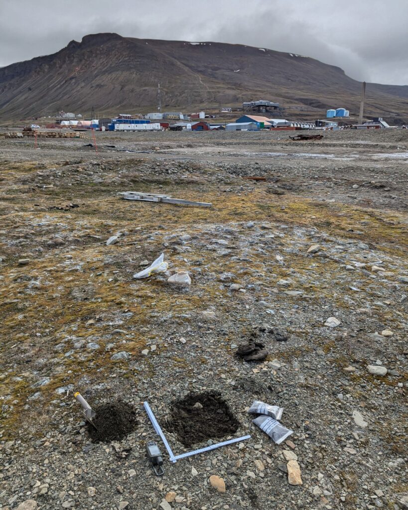
TASK DETAILS
WHERE WE DO IT
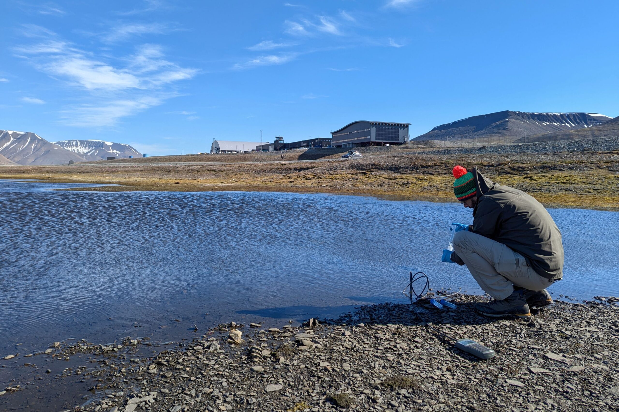
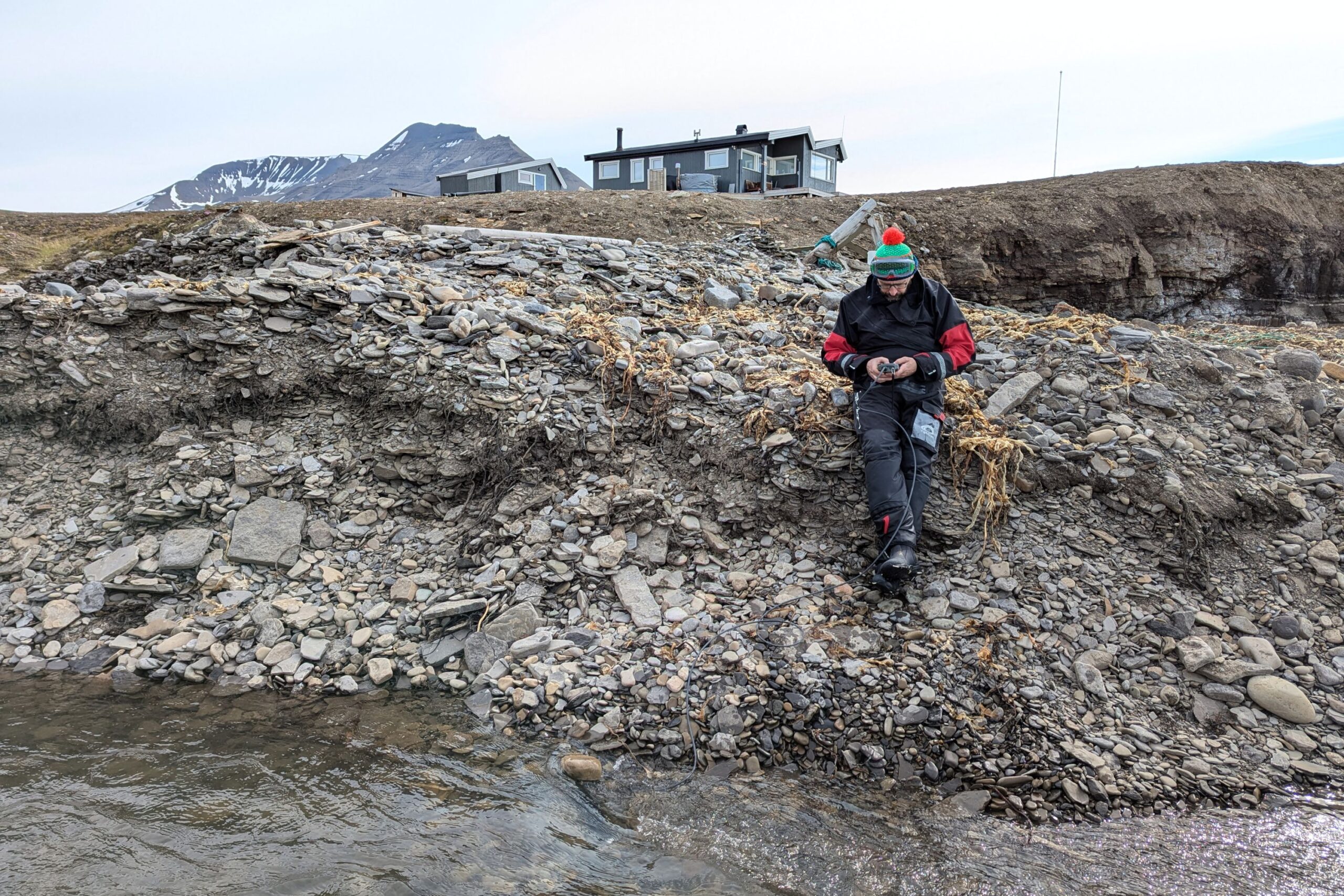
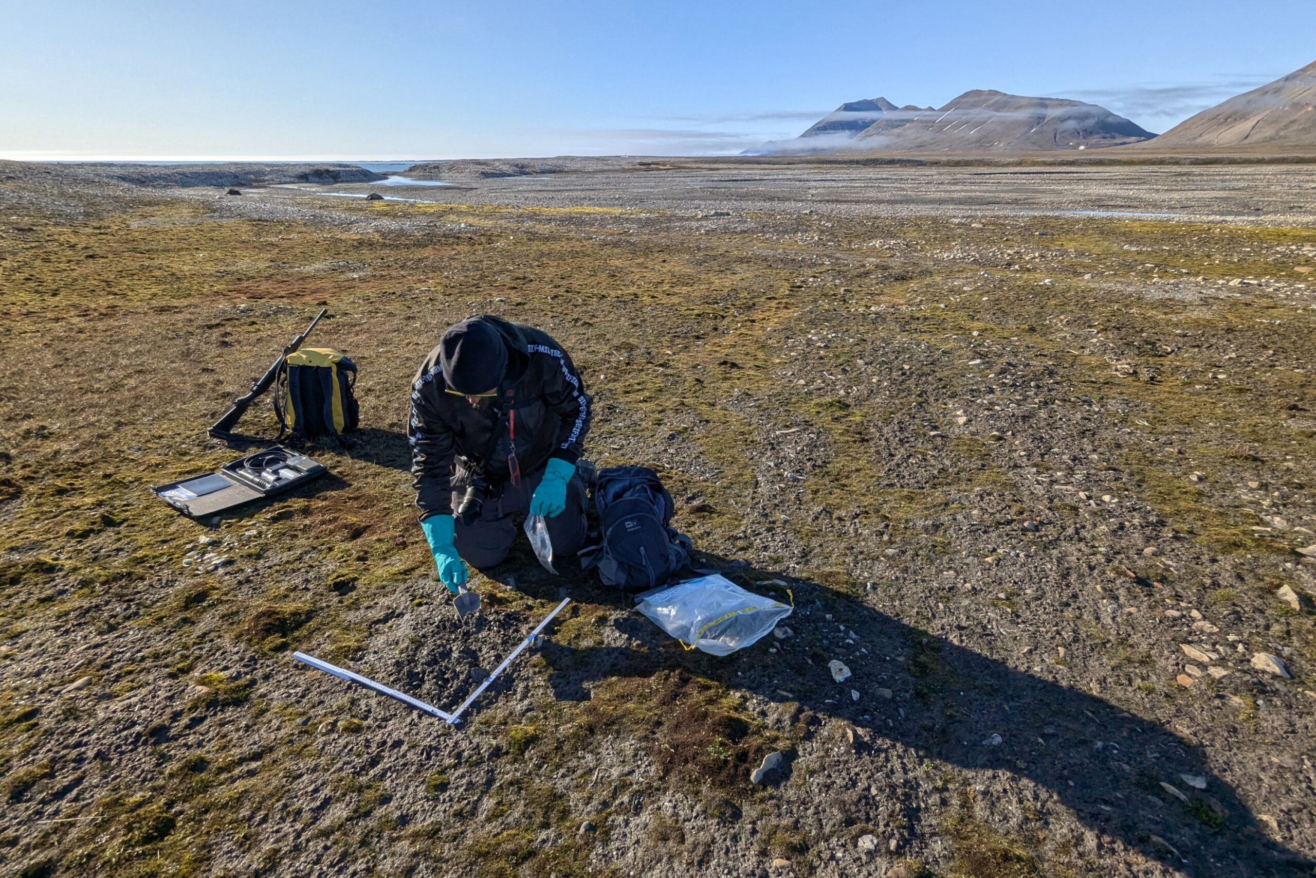
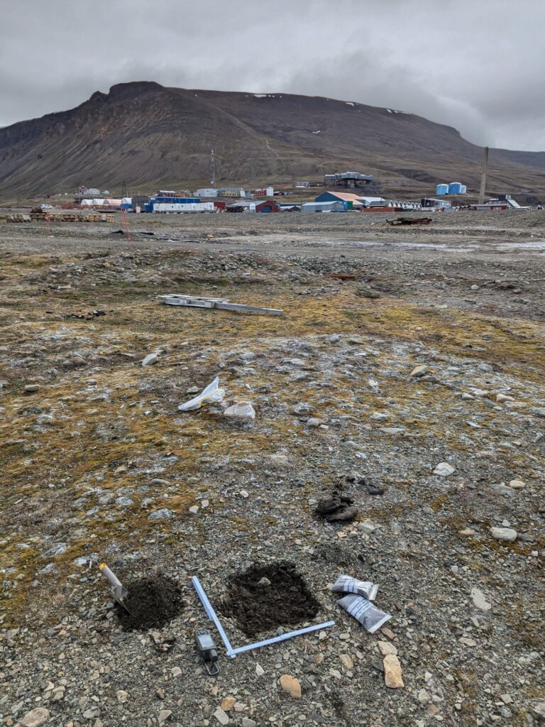
The environmental analysis which we carry out in Svalbard as part of the heavy metals task is based on samples collected in two very different areas of the archipelago. The first of them is the broadly-understood vicinity of Longyearbyen, the largest human settlement in Svalbard, located in the centre of Spitsbergen island. The other lies over 150 km to the south, within the same island and, at the same time, within Svalbard’s largest national park. The north-western edge of Sørkappland, because that’s the place we’re talking about, is an inaccessible Arctic wilderness, which we have already described in some detail in the context of our marine litter task. Why have we decided to focus on these two areas? Read on to find out.
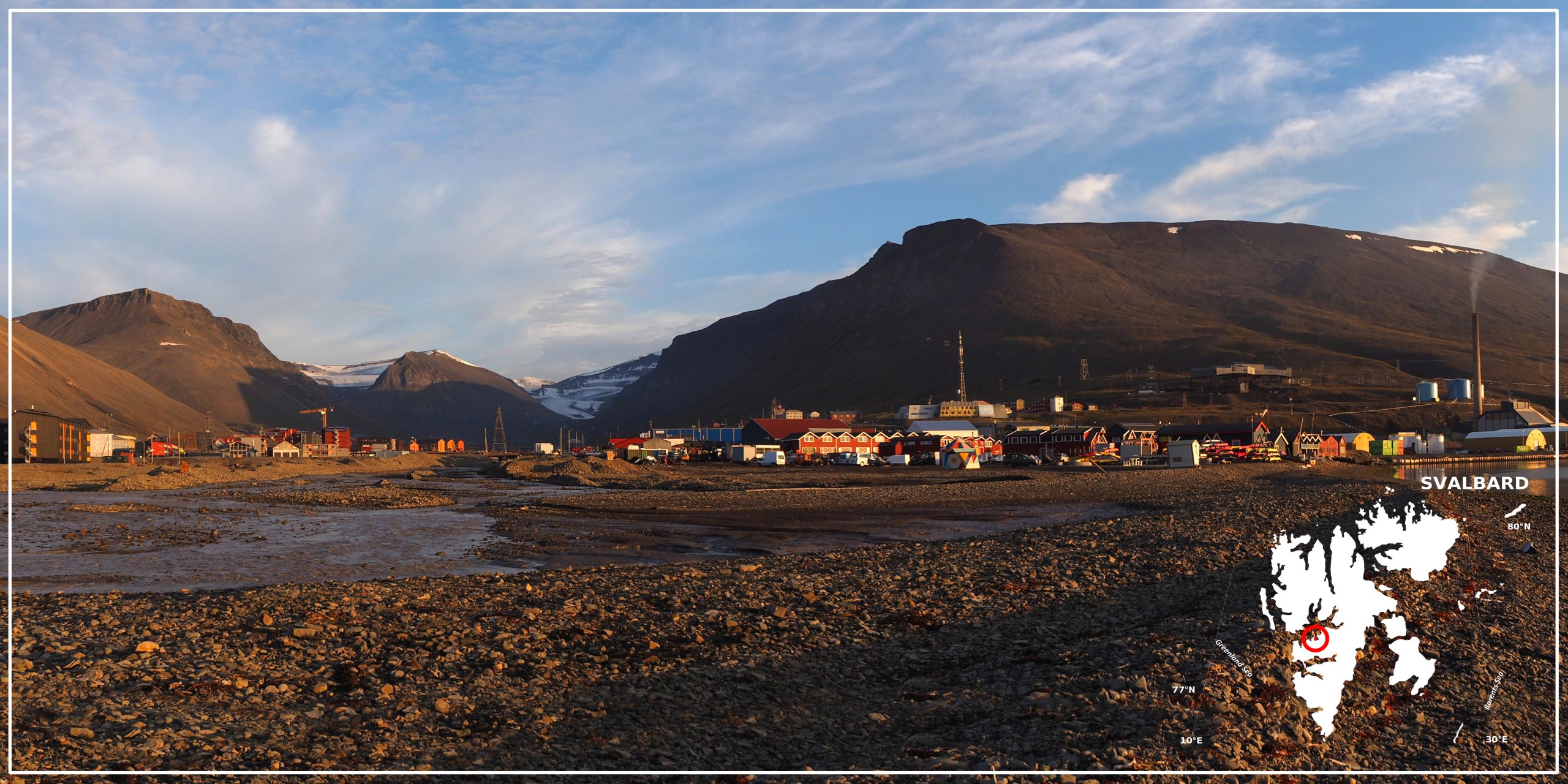
Background photo: Barbara Jóźwiak, forScience Foundation
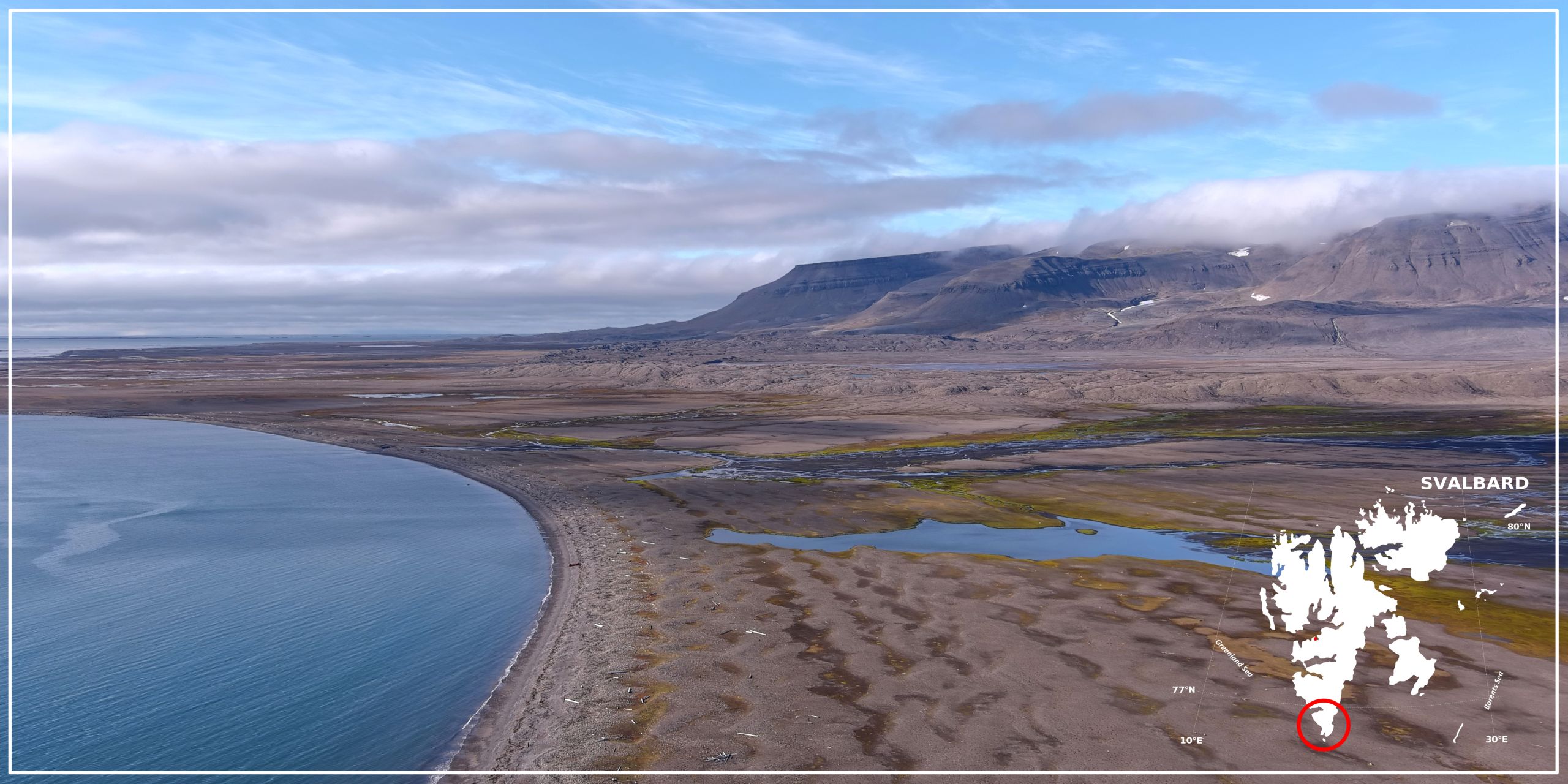
Background photo: Adam Nawrot, forScience Foundation
Longyearbyen was an obvious choice, because of all places in Svalbard it is there that human presence is the most visible. There’s a port, airport, power station, coal mine, dozens of cars, hundreds of snowmobiles, sewage, rubbish, exhaust fumes, you name it. Just as you would expect in a city. But although measuring heavy metal concentrations in soil and water is relatively simple, determining which values are the effect of direct human activity is a completely different story. Why? Because heavy metals travel. Carried by air masses, they arrive in the Arctic from far-off places, often thousands of kilometres away, and fall to Svalbard’s surface with rain and snow. And so it continues for many decades. As a result of this process and the fact that snow, ice and permafrost (known collectively as the cryosphere) absorb contaminants, the concentrations of heavy metals frozen-locked within them have been inevitably rising. Or rather, were rising, because the situation has changed. Today, with climate destabilization hard upon us and temperatures in Svalbard growing six time faster than the global average, the local cryosphere is melting at a startling rate and everything that has accumulated in it over the years is now being released into the soil and water. Moreover, changes in air mass movements, also caused by climate change, lead to increased summer precipitation, which not only accelerates the process of cryosphere melting and heavy metal release, but also ensures fresh contaminant supplies. And although many of them are no different from contaminants generated locally, they do not come from human activity in Svalbard. So how to draw a line between the indirect and direct human impact? With the help of Sørkappland.
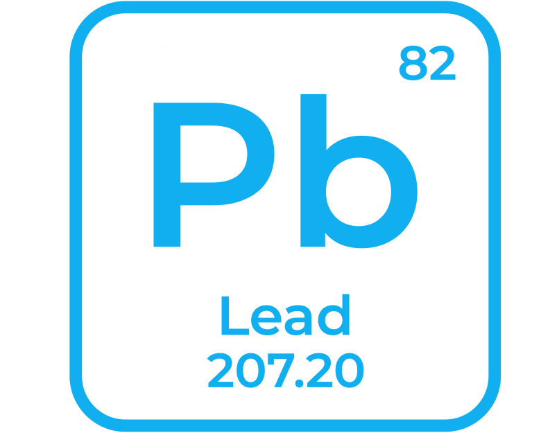
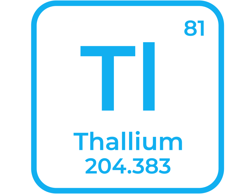
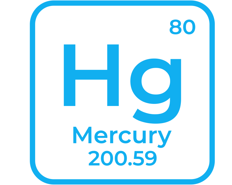
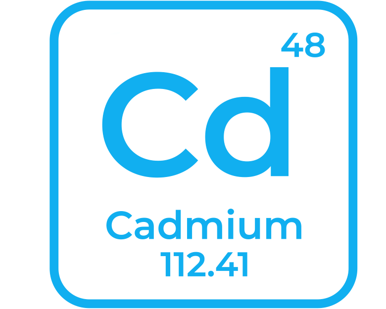
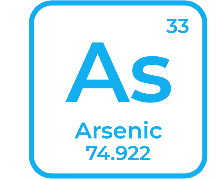
The most harmful from the list of sixty chemical elements which we measure in the collected samples
Sørkappland, as we’ve already mentioned, is a total wilderness. Inaccessible and untamed. Even in the era of unchecked exploitation of Svalbard’s biological resources, permanent settlement never developed in the area. And then, after the establishment of the national park, the number of visitors fell almost to zero. As a result, it makes sense to assume that heavy metals present in Sørkappland’s soil and water are the effect of contaminant release from the melting cryosphere or long-distance contaminant transport. Just like in the vicinity of Longyearbyen. There is, however, one fundamental difference: direct human impact, non-existent in Sørkappland. Research carried out in the area will, therefore, make it possible to determine Spitsbergen’s geochemical background, which is to say, initial heavy metal concentrations in soil and water. Afterwards, all we need to do is subtract the initial values from the overall values for Longyearbyen and we’ll get what we’re after. Because any surplus over the initial levels will be the effect of direct, locally-conducted human activity.
WHY WE DO IT
Even though heavy metals are a natural ingredient of the Earth’s crust, they are naturally present in the environment only in trace amounts. The thing is, however, that ever since the industrial revolution they have been extensively used in many aspects of our daily life. As a result, with a few exceptions such as volcano eruptions, soil erosion and forest fires, the modern-day sources of heavy metal contamination are overwhelmingly anthropogenic, meaning – they have everything to do with the activity of man. And because global production seems to grow faster than the awareness of its negative environmental consequences, heavy metal emissions are not too likely to go down in the foreseeable future.

Industry
Mining
Smelting
Oil refining
Wood processing

Transportation
Road infrastructure
Automotive industry
Internal combustion engines

Technology
E-waste
Batteries
Solar panels
Electric motors
City services
Urban waste storage
and disposal
Sewage management
Agriculture
Pesticides
Fertilizers
Examples of anthropological sources of heavy metal contamination
Why is this a problem? Because in certain circumstances heavy metals are highly toxic, and some of them – including mercury, lead and cadmium – are toxic regardless of the circumstances. Being non-biodegradable, heavy metals persist in the environment and accumulate in soils and waters, disrupting the vital roles they play in the ecosystems. It is in soils and waters that we study them, but their negative impact doesn’t end there. Due to the so-called bioaccumulation and biomagnification, heavy metals pile up in tissues and organs of living organisms and their concentration increases further up the food chain. Once in the system, they eventually cause damage to DNA and key proteins as well as disrupt hormonal activity, affecting many vital functions of an organism, such as growth, development, metabolism and reproduction. The issue of heavy metal contamination seems, therefore, quite significant, especially when we take into account where humans are in the food chain.
Data on the concentrations of selected chemical elements found in soil and water near Longyearbyen will improve the understanding of the city’s impact on its surroundings and the impact’s spatial extent. The data will also help to identify the main local sources of contamination and – in the longer run – to take steps towards reducing their negative impact of the environment. The environment, which is currently forced to deal with record rates of climate warming and, as such, hardly needs extra stressors in the form of toxic pollutants.
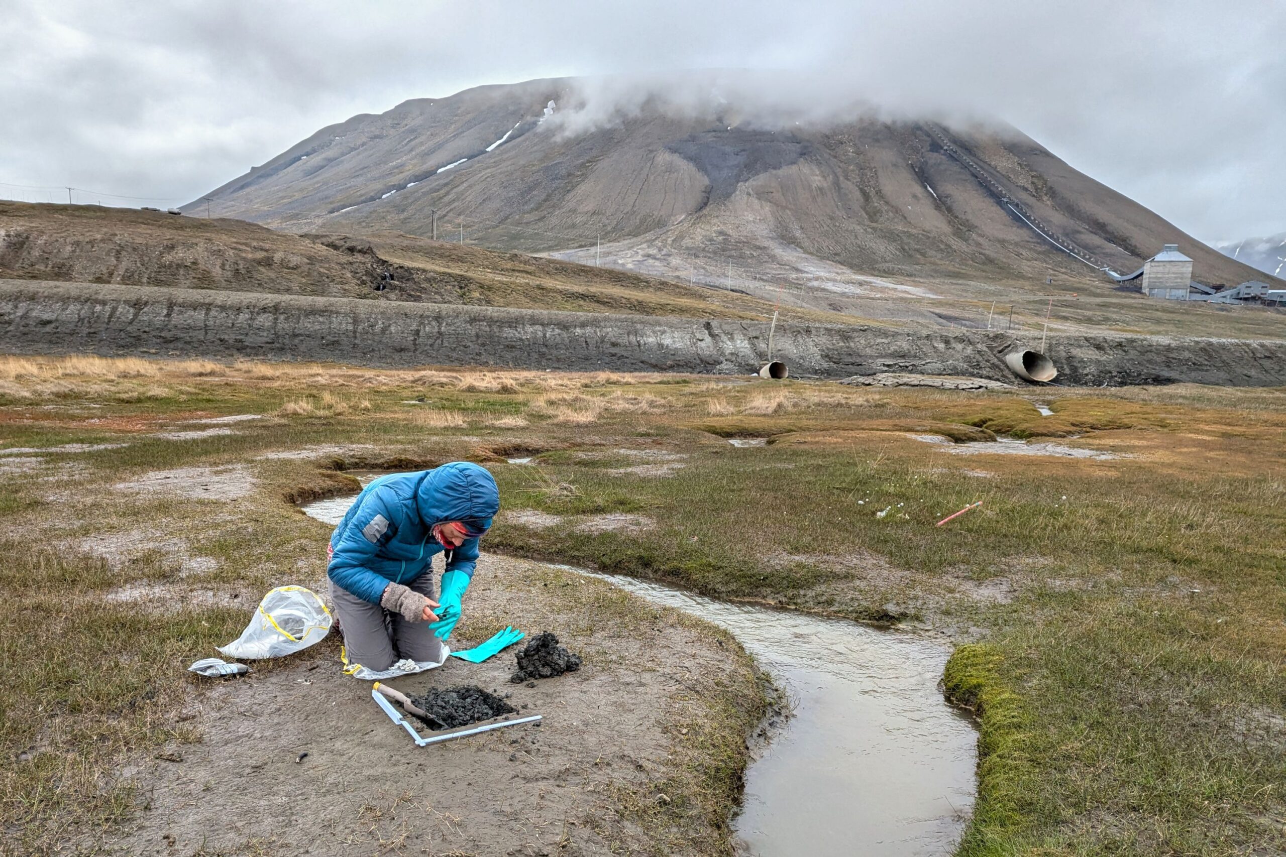
© Adam Nawrot, forScience Foundation
© Barbara Jóźwiak, forScience Foundation
© Barbara Jóźwiak, forScience Foundation
© Adam Nawrot, forScience Foundation
WHAT SETS US APART
Research into the concentration of harmful chemicals in the vicinity of human settlements has been carried out in Svalbard for a while now. Data from remote parts of the archipelago, however, is still scarce. It is Sørkappland, therefore, that makes our study unique. And because we go there anyway for marine litter, the collection of soil and water samples involves no extra transportation and thus causes no increase in the carbon footprint generated by the forScience team.
What is more, by integrating the two main tasks we carry out under project ICEBERG, we’re able to collect the samples in both target areas – near Longyearbyen and in Sørkappland – over just a few weeks, which means the comparison of results will be more reliable.
And speaking of results, another thing that gives us an advantage is a long-standing cooperation with the Faculty of Chemistry at the Adam Mickiewicz University in Poznań, Poland. It is in one of their labs that the samples we collect are analysed with the use of state-of-the-art analytical techniques, including the so-called inductively coupled plasma mass spectrometry (ICP-MS), under the watchful eye of an expert in the field, Professor Przemysław Niedzielski.
Up for even more information? Go ahead and visit our Facebook page.

HEAVY METALS TASK
The task involves a detailed analysis of the chemical composition of Svalbard’s soil and fresh water. By comparing the concentrations of selected elements in samples collected near Longyearbyen and in an uninhabited region of Sørkappland, we try to assess the environmental impact of direct human activity and the impact’s spatial extent. The collected data will help understand the scale of heavy metal contamination in Svalbard and facilitate identification of its local sources.
Task details
WHERE WE DO IT
The environmental analysis which we carry out in Svalbard as part of the heavy metals task is based on samples collected in two very different areas of the archipelago. The first of them is the broadly-understood vicinity of Longyearbyen, the largest human settlement in Svalbard, located in the centre of Spitsbergen island. The other lies over 150 km to the south, within the same island and, at the same time, within Svalbard’s largest national park. The north-western edge of Sørkappland, because that’s the place we’re talking about, is an inaccessible Arctic wilderness, which we have already described in some detail in the context of our marine litter task. Why have we decided to focus on these two areas? Read on to find out.

Background photo: Barbara Jóźwiak, forScience Foundation

Background photo: Adam Nawrot, forScience Foundation
Longyearbyen was an obvious choice, because of all places in Svalbard it is there that human presence is the most visible. There’s a port, airport, power station, coal mine, dozens of cars, hundreds of snowmobiles, sewage, rubbish, exhaust fumes, you name it. Just as you would expect in a city. But although measuring heavy metal concentrations in soil and water is relatively simple, determining which values are the effect of direct human activity is a completely different story. Why? Because heavy metals travel. Carried by air masses, they arrive in the Arctic from far-off places, often thousands of kilometres away, and fall to Svalbard’s surface with rain and snow. And so it continues for many decades. As a result of this process and the fact that snow, ice and permafrost (known collectively as the cryosphere) absorb contaminants, the concentrations of heavy metals frozen-locked within them have been inevitably rising. Or rather, were rising, because the situation has changed. Today, with climate destabilization hard upon us and temperatures in Svalbard growing six time faster than the global average, the local cryosphere is melting at a startling rate and everything that has accumulated in it over the years is now being released into the soil and water. Moreover, changes in air mass movements, also caused by climate change, lead to increased summer precipitation, which not only accelerates the process of cryosphere melting and heavy metal release, but also ensures fresh contaminant supplies. And although many of them are no different from contaminants generated locally, they do not come from human activity in Svalbard. So how to draw a line between the indirect and direct human impact? With the help of Sørkappland.


The most harmful from the list of sixty chemical elements which we measure in the collected samples
Sørkappland, as we’ve already mentioned, is a total wilderness. Inaccessible and untamed. Even in the era of unchecked exploitation of Svalbard’s biological resources, permanent settlement never developed in the area. And then, after the establishment of the national park, the number of visitors fell almost to zero. As a result, it makes sense to assume that heavy metals present in Sørkappland’s soil and water are the effect of contaminant release from the melting cryosphere or long-distance contaminant transport. Just like in the vicinity of Longyearbyen. There is, however, one fundamental difference: direct human impact, non-existent in Sørkappland. Research carried out in the area will, therefore, make it possible to determine Spitsbergen’s geochemical background, which is to say, initial heavy metal concentrations in soil and water. Afterwards, all we need to do is subtract the initial values from the overall values for Longyearbyen and we’ll get what we’re after. Because any surplus over the initial levels will be the effect of direct, locally-conducted human activity.
WHY WE DO IT
Even though heavy metals are a natural ingredient of the Earth’s crust, they are naturally present in the environment only in trace amounts. The thing is, however, that ever since the industrial revolution they have been extensively used in many aspects of our daily life. As a result, with a few exceptions such as volcano eruptions, soil erosion and forest fires, the modern-day sources of heavy metal contamination are overwhelmingly anthropogenic, meaning – they have everything to do with the activity of man. And because global production seems to grow faster than the awareness of its negative environmental consequences, heavy metal emissions are not too likely to go down in the foreseeable future.

Industry
Mining
Smelting
Oil refining
Wood processing

Transportation
Road infrastructure
Automotive industry
Internal combustion engines

Technology
E-waste
Batteries
Solar panels
Electric motors

City services
Urban waste storage
and disposal
Sewage management

Agriculture
Pesticides
Fertilizers
Examples of anthropological sources of heavy metal contamination
Why is this a problem? Because in certain circumstances heavy metals are highly toxic, and some of them – including mercury, lead and cadmium – are toxic regardless of the circumstances. Being non-biodegradable, heavy metals persist in the environment and accumulate in soils and waters, disrupting the vital roles they play in the ecosystems. It is in soils and waters that we study them, but their negative impact doesn’t end there. Due to the so-called bioaccumulation and biomagnification, heavy metals pile up in tissues and organs of living organisms and their concentration increases further up the food chain. Once in the system, they eventually cause damage to DNA and key proteins as well as disrupt hormonal activity, affecting many vital functions of an organism, such as growth, development, metabolism and reproduction. The issue of heavy metal contamination seems, therefore, quite significant, especially when we take into account where humans are in the food chain.
Data on the concentrations of selected chemical elements found in soil and water near Longyearbyen will improve the understanding of the city’s impact on its surroundings and the impact’s spatial extent. The data will also help to identify the main local sources of contamination and – in the longer run – to take steps towards reducing their negative impact of the environment. The environment, which is currently forced to deal with record rates of climate warming and, as such, hardly needs extra stressors in the form of toxic pollutants.

© Adam Nawrot, forScience Foundation

© Barbara Jóźwiak, forScience Foundation

© Barbara Jóźwiak, forScience Foundation

© Adam Nawrot, forScience Foundation
WHAT SETS US APART
Research into the concentration of harmful chemicals in the vicinity of human settlements has been carried out in Svalbard for a while now. Data from remote parts of the archipelago, however, is still scarce. It is Sørkappland, therefore, that makes our study unique. And because we go there anyway for marine litter, the collection of soil and water samples involves no extra transportation and thus causes no increase in the carbon footprint generated by the forScience team.
What is more, by integrating the two main tasks we carry out under project ICEBERG, we’re able to collect the samples in both target areas – near Longyearbyen and in Sørkappland – over just a few weeks, which means the comparison of results will be more reliable.
And speaking of results, another thing that gives us an advantage is a long-standing cooperation with the Faculty of Chemistry at the Adam Mickiewicz University in Poznań, Poland. It is in one of their labs that the samples we collect are analysed with the use of state-of-the-art analytical techniques, including the so-called inductively coupled plasma mass spectrometry (ICP-MS), under the watchful eye of an expert in the field, Professor Przemysław Niedzielski.
Up for even more information? Go ahead and visit our Facebook page.
So that’s our own little tip of the ICEBERG. We hope we’ve managed to answer all your questions. If we haven’t, drop us a line. And if you wish to learn more about the remaining work packages and tasks carried out by other project partners, visit the project’s official website and social media channels. You’ll find all the links here.

